
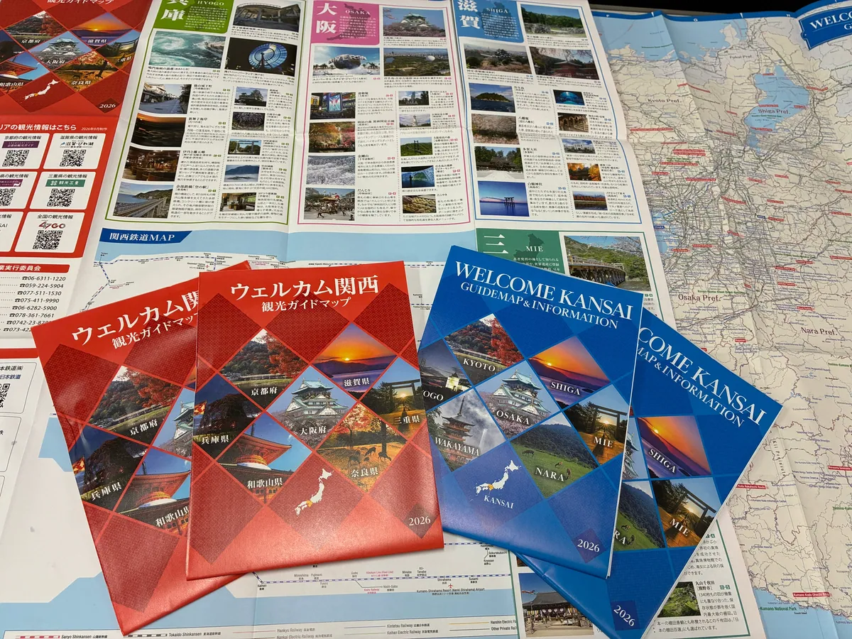
It might just make you want to venture into the next prefecture this weekend. The 2026 edition of the “Welcome Kansai Tourist Guide Map”, made for trips that cross prefectural borders around Kansai, has been published. It puts tourist and transport information for seven prefectures — Mie, Shiga, Kyoto, Osaka, Hyogo, Nara and Wakayama — on a single sheet, and comes in two versions, Japanese and English. It is handed out at tourist information centers and elsewhere, and can also be downloaded as a PDF.
Tourist information on one side, a wide-area map of Kansai on the other
The map was produced by the Kansai Block Wide-Area Tourism Promotion Council, through which the seven prefectures work together to promote tourism across the region. Its secretariat is the Kansai office of the Japan Travel and Tourism Association.
The map is A1 size and printed on both sides, accordion-folded and then folded in three. The information side lists sights in each prefecture with photos, along with a Kansai railway map and QR codes linking to each prefecture’s tourism website. The other side is a wide-area map showing all seven prefectures at once.
The aim is to help travelers from Japan and abroad as they move around the region across prefectural borders.
It is useful for people who live in Kansai, too. With the railway map and the wide-area map on one sheet, you can spread it out and plan day trips that cross prefectures, such as “Kyoto to Nara” or “Osaka to Wakayama”.
An English edition for visitors from overseas
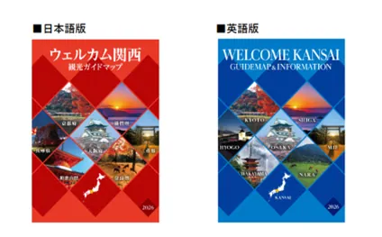
The Japanese edition has a red cover and the English edition a blue one. The English edition, titled “WELCOME KANSAI GUIDE MAP & INFORMATION”, is made for international visitors to Japan. If friends or family are coming from overseas, you could send them the PDF in advance.
The map is distributed at tourism fairs held under the Kansai Block Wide-Area Tourism Promotion Project and at tourist information centers in each prefecture, among other places. Even without a paper copy, both editions can be downloaded from the Japan Travel and Tourism Association website as separate PDFs for the information side and the map side. The map-side PDFs are fairly large — about 27MB for the Japanese edition and about 21MB for the English edition — so Wi-Fi is a good idea if you are opening them on a smartphone.
Details
- Name: Welcome Kansai Tourist Guide Map, 2026 edition (English edition: WELCOME KANSAI GUIDE MAP & INFORMATION)
- Area covered: Mie, Shiga, Kyoto, Osaka, Hyogo, Nara and Wakayama prefectures
- Format: A1, double-sided, accordion-folded and folded in three
- Languages: Japanese and English
- Main contents: tourist information for each prefecture, a Kansai railway map, QR codes to each prefecture’s tourism website, a wide-area map of Kansai
- Where to get it: tourism fairs of the Kansai Block Wide-Area Tourism Promotion Project, tourist information centers in each prefecture, and more
- Published by: Kansai Block Wide-Area Tourism Promotion Council (secretariat: Japan Travel and Tourism Association, Kansai office)
- Japanese edition PDFs: information side https://www.nihon-kankou.or.jp/home/userfiles/files/kansaimap_jp_guide_2026.pdf / map side https://www.nihon-kankou.or.jp/home/userfiles/files/kansaimap_jp_map_2026.pdf
- English edition PDFs: information side https://www.nihon-kankou.or.jp/home/userfiles/files/kansaimap_en_guide_2026.pdf / map side https://www.nihon-kankou.or.jp/home/userfiles/files/kansaimap_en_map_2026.pdf
- Japan Travel and Tourism Association (Japanese): https://www.nihon-kankou.or.jp/home/